

SAN DIEGO — Expect warm and sunny conditions to prevail in San Diego County through the rest of the week, though these types of conditions are rather typical for San Diego during this time of the year. Most afternoon highs around the county are peaking in the near seasonal range. Coastal clouds will kick off each morning before only a few passing clouds win out in the afternoon.
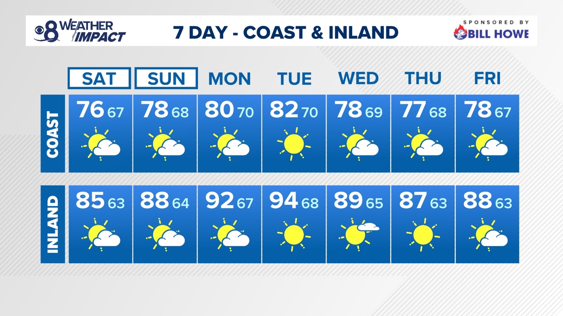
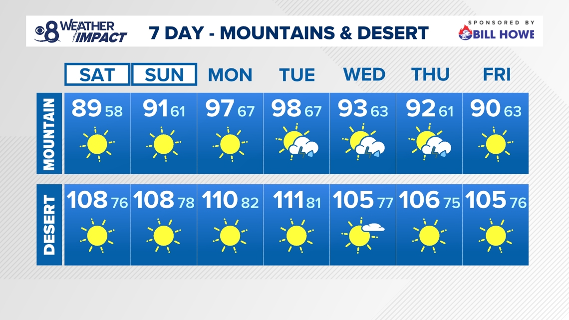
A trough of low pressure to the north is doing its best at keeping a strong ridge of high pressure to the east of us. The high pressure system has already started to make its way slowly back west. The low will trigger onshore flow this weekend. This will help to bring temperatures down a few degrees. The 70s will stick around for the coast, but the inland valleys and mountains will be back to widespread 80s.
The marine layer is expected to remain active with a chance of morning fog, low clouds, and maybe a little misty at times in the morning. A coastal eddy, developing into the start of the weekend, will also push the night and morning cloud cover a little more inland, which will aid in the minor slip in temperatures.
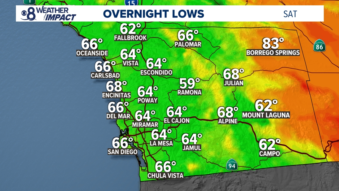
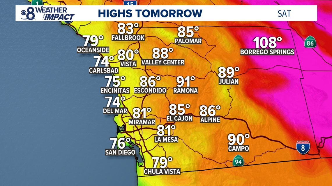
SATURDAY TEMPERATURES:
Our heat will max out near seasonal for the Summer season here in San Diego County. We will remain within about 5 degrees of normal regardless of where you are.


SEASONAL (AVERAGE) DAYTIME HIGHS:
- Coastal highs near 76 to 78 degrees
- Inland valley highs near 91 degrees
- Mountain highs near 85 degrees
- Desert highs near 107 degrees
AT THE COAST:
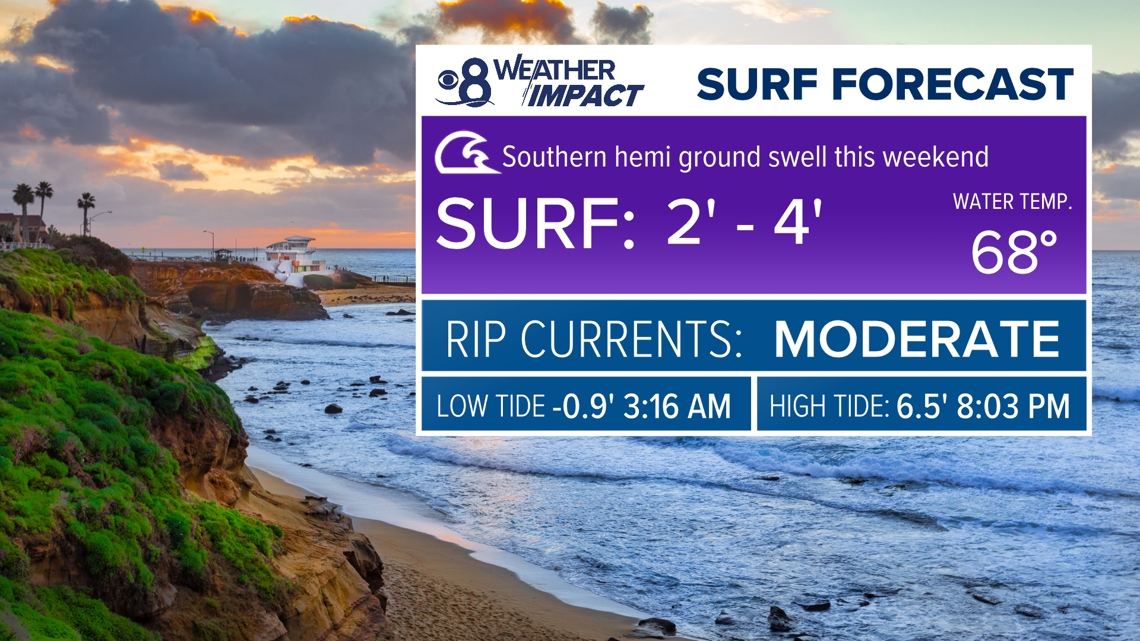
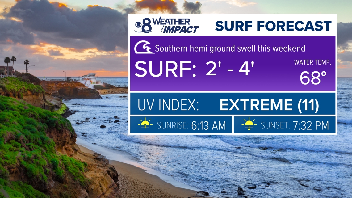
Surf heights will remain 2 to 4 feet with a moderate risk of rip currents through Saturday. The surf will subside a little more to 1 to 3 feet with a low risk on Sunday.


As the strong ridge east of us builds back over the West, expect a countywide warm up by the start of next week. Temperatures will peak warmer than usual with 80s at the coast, 90s for the inland valleys and mountains and highs near 110 degrees in the desert on Monday and Tuesday. Now, we'll be on the lookout for potential heat alerts in the days ahead.
Additionally, models are back to showing an influx of monsoonal moisture. It will be minor with the potential for an isolated showers and thunderstorms, mainly in the mountains, on Tuesday, Wednesday and Thursday during the afternoon/early evening hours. The risk is low for Tuesday and Thursday with a slightly better chance on Wednesday.
Stay current on the microclimate forecast by downloading the CBS 8 app on your cell phone and the CBS 8+ app on Roku and Amazon Fire TV. There you’ll find all our newscasts, specials, the latest weather forecasts, breaking news, and much more.


HERE ARE MORE WAYS TO GET CBS 8:
ADD THE CBS8+ APP TO YOUR STREAMING DEVICE Roku | Amazon Fire